


2024 zap chapelle

ISAGIL
User

Length
18.2 km

Max alt
2290 m

Uphill gradient
218 m
Km-Effort
25 km

Min alt
1092 m

Downhill gradient
1349 m
Boucle
No
Creation date :
2024-07-19 06:37:22.531
Updated on :
2024-07-20 07:43:56.091
7h01
Difficulty : Very difficult

FREE GPS app for hiking
 SityTrail
IGN / Geographical institutes
SityTrail Plus
The world is yours!
About
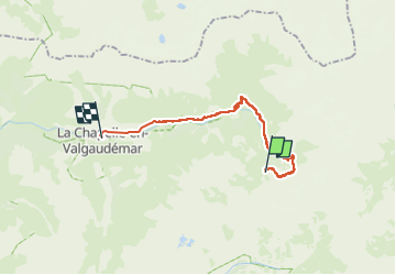
Trail Walking of 18.2 km to be discovered at Provence-Alpes-Côte d'Azur, Hautes-Alpes, La Chapelle-en-Valgaudémar. This trail is proposed by ISAGIL.
Positioning
Country:
France
Region :
Provence-Alpes-Côte d'Azur
Department/Province :
Hautes-Alpes
Municipality :
La Chapelle-en-Valgaudémar
Location:
Unknown
Start:(Dec)
Start:(UTM)
286294 ; 4964592 (32T) N.
Comments